

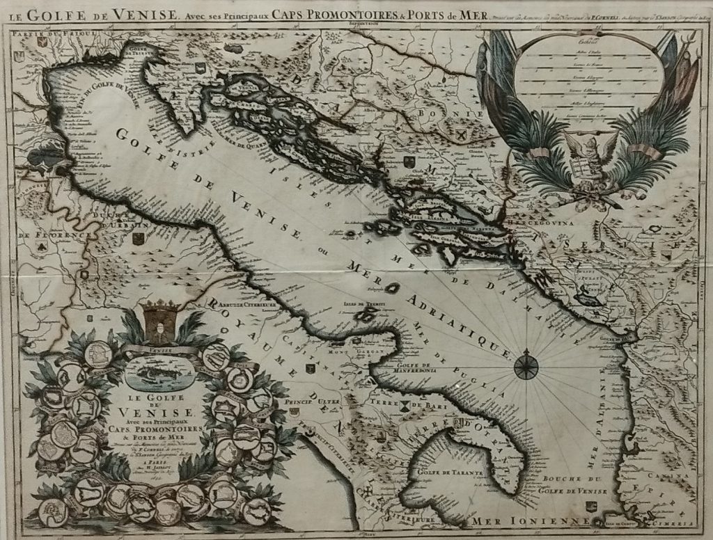
Incisione in rame di 565 x 745 mm., in delicata acquarellatura coeva. In alto, sopra il riquadro, ma dentro la battuta “Le Golfe De Venise, Avec Ses Principaux Caps, Promontoires, and Ports de Mer. Dressè sur Les Memoires les plus Nouveaux du P. Corneli & autres. Par le S. Sanson, Geographe du Roy”. Alexis Hubert Jaillot (1632-1712). Questa grande e bella mappa del Mare Adriatico, riprende chiaramente quella molto simile del Coronelli, pubblicata a Venezia poco prima. Sono indicati tutti i possedimenti della Repubblica, con una piccola pianta di Venezia entro un ricco cartiglio, arricchito dallo schema delle principali città presenti nella carta.
Copper engraving measuring 565 x 745 mm, with delicate contemporary watercolouring. At the top, above the panel but within the border, is the inscription “Le Golfe De Venise, Avec Ses Principaux Caps, Promontoires, and Ports de Mer. Dressè sur Les Memoires les plus Nouveaux du P. Corneli & autres. Par le S. Sanson, Geographe du Roy”. Alexis Hubert Jaillot (1632-1712). This large and beautiful map of the Adriatic Sea clearly echoes the very similar one by Coronelli, published in Venice shortly before. All the possessions of the Republic are indicated, with a small map of Venice within a rich cartouche, embellished with a diagram of the main cities featured on the map.